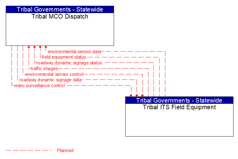
Interface: Tribal MCO Dispatch - Tribal ITS Field Equipment
Information Flow Definitions
environmental sensor control (Planned) Selected Comm Solution
Data used to configure and control environmental sensors.
environmental sensor data (Planned) Selected Comm Solution
Current road conditions (e.g., surface temperature, subsurface temperature, moisture, icing, treatment status) and surface weather conditions (e.g., air temperature, wind speed, precipitation, visibility) as measured and reported by fixed and/or mobile environmental sensors. Operational status of the sensors is also included.
field equipment status (Planned) Selected Comm Solution
Reports from field equipment (sensors, signals, signs, controllers, etc.) which indicate current operational status.
roadway dynamic signage data (Planned) Selected Comm Solution
Information used to initialize, configure, and control dynamic message signs. This flow can provide message content and delivery attributes, local message store maintenance requests, control mode commands, status queries, and all other commands and associated parameters that support remote management of these devices.
roadway dynamic signage status (Planned) Selected Comm Solution
Current operating status of dynamic message signs.
traffic images (Planned)
High fidelity, real–time traffic images suitable for surveillance monitoring by the operator or for use in machine vision applications. This flow includes the images. Meta data that describes the images is contained in another flow.
video surveillance control (Planned) Selected Comm Solution
Information used to configure and control video surveillance systems.